
Mapping
A mute map,
or an argument?
Mapping is not confined to depicting a territory. It allows you to understand, to decide and to act with your eyes open: it turns complex data into a simple, operational reading of what is at stake.
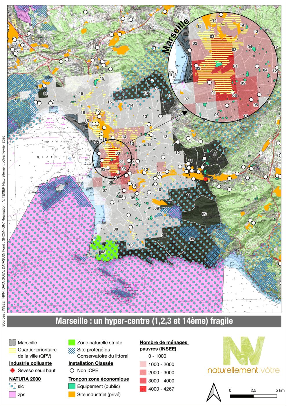
Representations & analyses
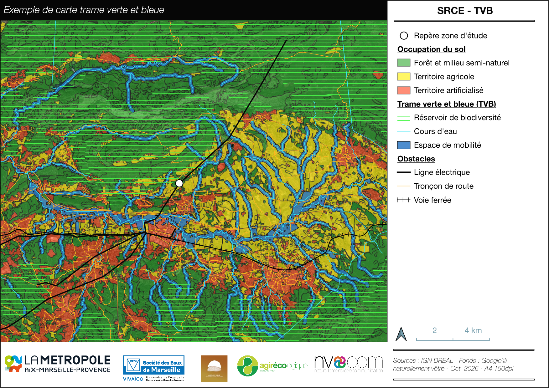
Natural heritage
The Regional Ecological Coherence Scheme (SRCE) and the Green and Blue Infrastructure (TVB) together form a national ecological network intended to preserve biodiversity. In the face of habitat fragmentation, this framework makes it possible to maintain and restore ecological continuity.
What it makes possible. Movement, feeding and reproduction for living species.
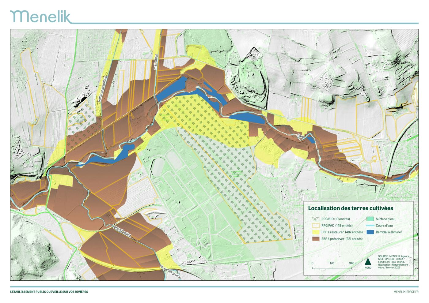
Uses
The concentration of uses in certain areas reveals zones under pressure — and, by contrast, less solicited spaces that may become opportunities for ecological action or an offset measure.
What it makes possible. Identifying where uses coexist and where they clash, and anticipating the conditions for acceptance.
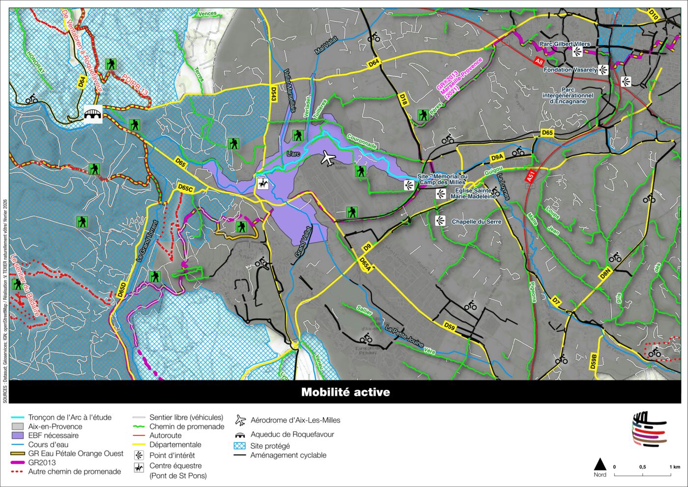
Movement and fragmentation
Traffic routes and heavily used areas trace out how the territory is fragmented: what moves through, what comes up against an obstacle, what goes around.
What it makes possible. Telling functional continuities apart from obstacles, human as much as ecological, and taking them into account in planning.
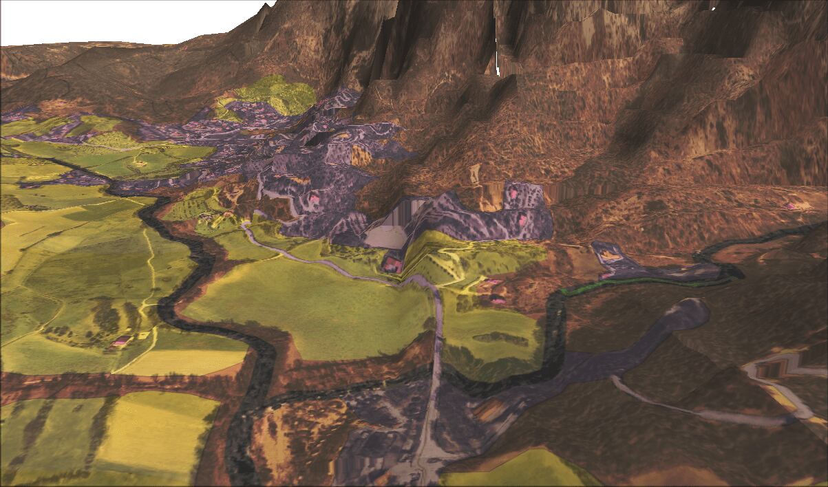
HD LiDAR and digital terrain model
The fine structure of the relief, read at metre resolution: water flow, potential wetlands, topographic constraints the ground does not reveal at a glance.
What it makes possible. Grounding planning and management choices in the physical reality of the site, not in its appearance.
Predictive maps
Where a species stands a chance of being, and where two independent methods agree. These maps are not drawn: they are computed from known records and from a fine-grained description of the ground, then checked against areas the model has never seen.
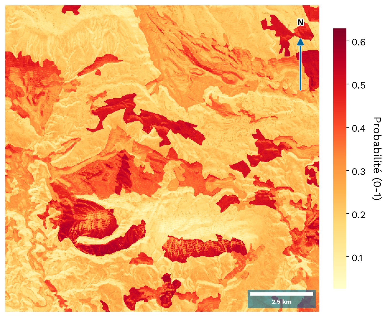
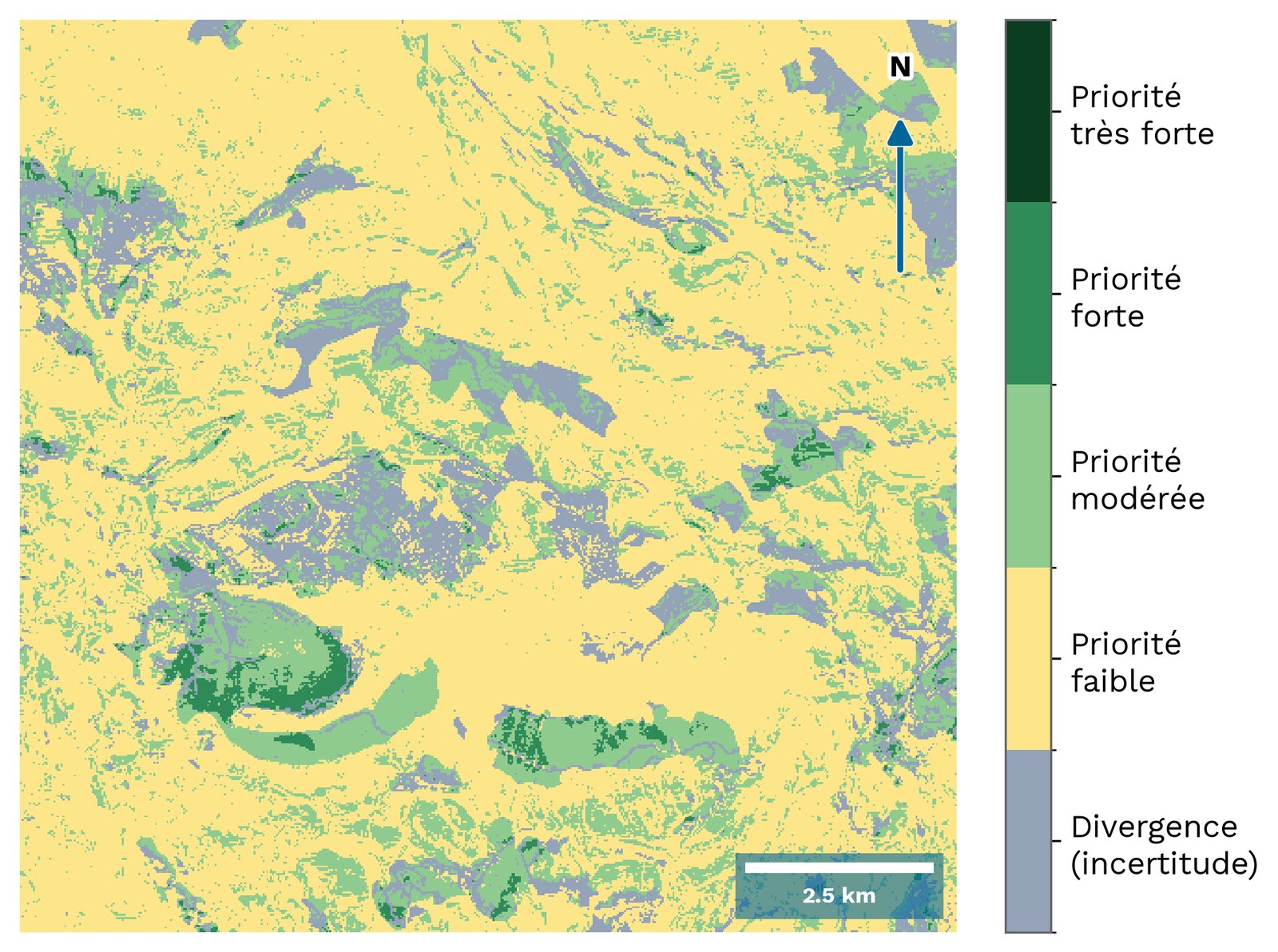
What they make possible. Targeting the survey effort — where to go, at what time of year — and showing, map in hand, the areas where caution is called for. A map that does not name its own uncertainty cannot be defended the day the case is challenged. Both of these plates are produced by TerrArgos.
A case in point
Which model for the Spanish Festoon?
What is really being modelled is not the butterfly. It is the birthwort. Zerynthia rumina is strictly dependent on Aristolochia pistolochia: no birthwort, no Spanish Festoon, however inviting the slope may look.
A model built on relief alone will return “xeric grassland, south-facing, limestone substrate, low altitude”. That is to say, the habitat of the plant. It therefore works as an approximation — but it will also flag perfectly suitable slopes where the birthwort is absent. That is where a model of this kind overestimates, and it does so systematically.
- First tierThe host plant
- Second tierThe butterfly, conditioned on it
Two tiers, then. It takes longer to build, and it is the only way not to sell an area that does not exist. The same logic underpins TerrArgos, our geospatial decision platform.
What we supply
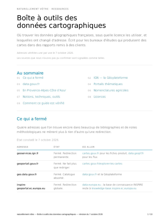
Guide to data providers
A survey of the sources available in France, updated on 7 October 2026.
Style guide
Colours, typefaces, layout, symbols. Your plates become recognisable before they are read, and your later exports follow suit without effort.
The files, not just the images
High-definition plates, and the GIS layers behind them where the engagement provides for it — enough to take the work forward yourself.